The Journal
An island. A point of view.
All editions ↗
EN ⌄
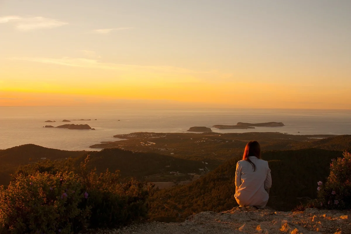
A seated walker looking over Ibiza’s western islets from Sa Talaia in warm evening light
The Hiking Edition · Ibiza, SpainThe island, under your own steam.

The island,
on foot.

A summit above Sant Josep, the fields of Corona, a striped lighthouse on the northern edge. Walk into the spaces between the places you know.

Step inside ↓
Sa Talaia / the island taking shape
The Hiking EditionIbiza · The Journal

The view means more when you have walked your way into it.

The last bend, a little breathlessness, the friend who was talking all the way up going quiet. From a beach, an offshore island is part of the scenery. From higher ground, you can begin to place it: beyond that bay, across from that headland, a long way from the cove where you swam yesterday. The effort has given the view a shape you can remember.

A holiday spent between villas, restaurants and beaches can turn Ibiza into a collection of excellent addresses. On foot, the land between them becomes interesting in its own right. Dry-stone walls follow the contours. Cultivated plots interrupt the pine cover. A path connects a village to the reason it was built there. There is much more country than the drive suggests.

Begin with the sort of morning you actually want. Sa Talaia has the satisfaction of a summit. Corona alternates farmland and open sea. The northern headlands ask for greater attention to the ground beneath your feet. Down at Ses Salines, a pair of binoculars can be more rewarding than another kilometre.
For a first ascent

Sa Talaia from Sant Josep: use the specific municipal 2.4 km outward route.

For the countryside

Pla de Corona is a 6.8 km circuit; Sant Mateu–Es Camp Vell is a more demanding 10.7 km.

For water and sky

Choose the northern Moscarter coast or the paths and observation points of Ses Salines according to conditions.

Get your bearings

Above the
places you know.

Sa Talaia makes a first walking day feel like an introduction to the whole island.

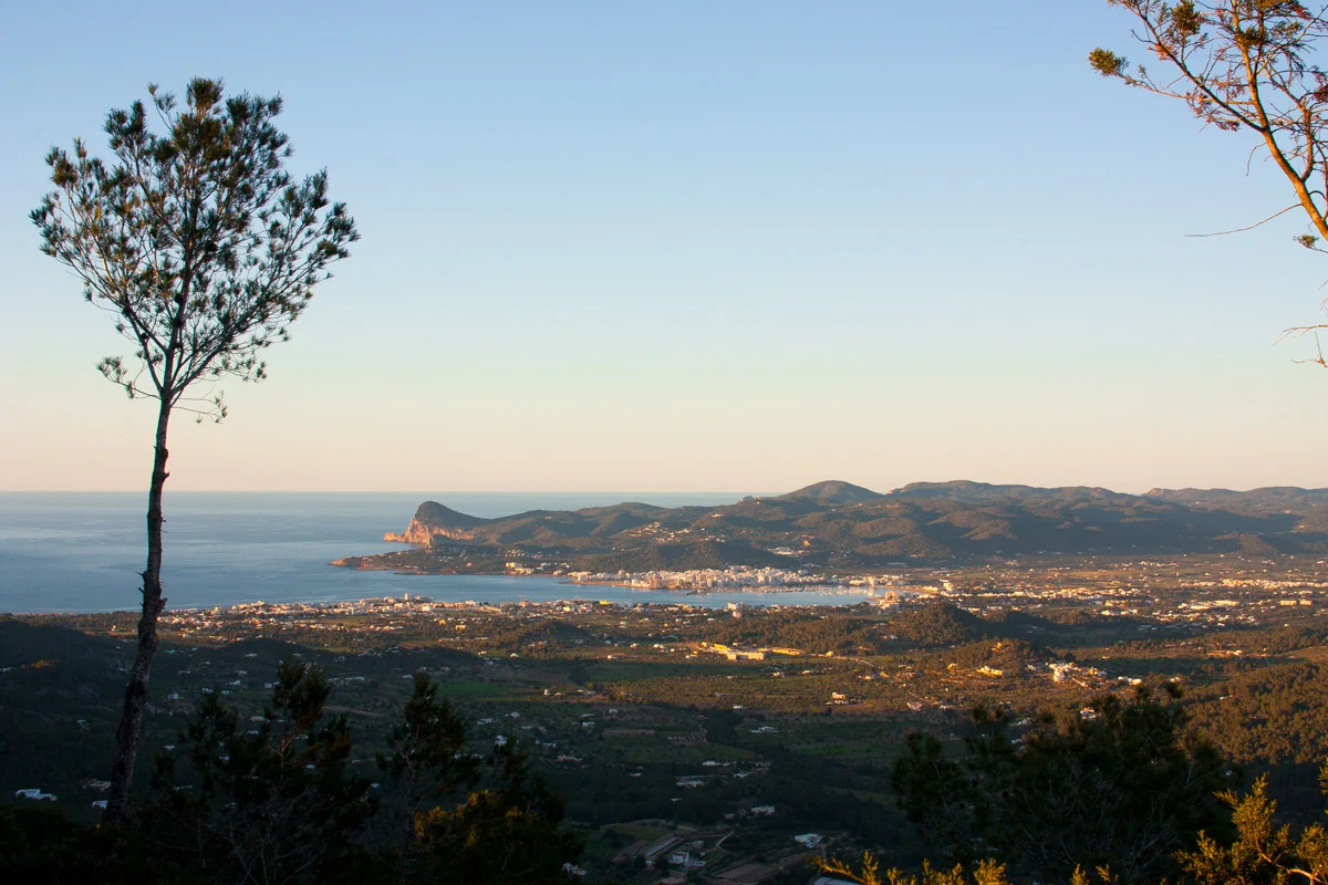
Sant Antoni Bay seen across the trees from Sa Talaia
Sa Talaia / Sant Antoni Bay below
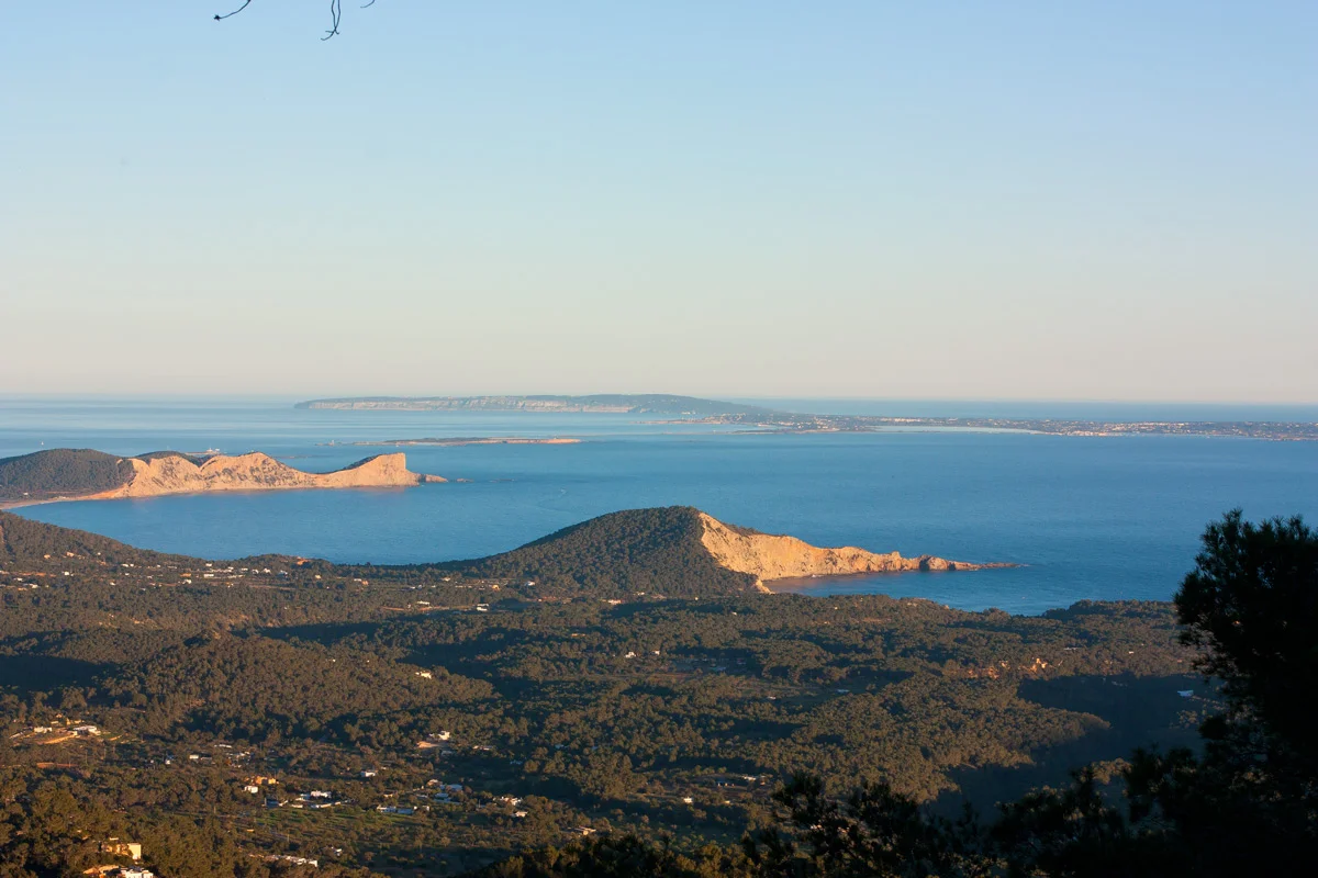
The southern coast and Formentera seen from Sa Talaia in warm light
Sa Talaia / the southern outlook

Start at Sant Josep church and follow the municipal ascent along Carrer de sa Talaia, past Can Jeroni. The village gradually loosens into country paths. That first stretch is worth noticing: the walk begins among the ordinary edges of a settlement, before the pine cover and the higher ground change its scale. You are climbing out of a place, rather than simply appearing at a viewpoint.

At 475 metres, Sa Talaia is Ibiza’s highest point. The sea gives that modest height a surprising authority. In clear conditions, Sant Antoni Bay spreads out on one side, while the southern outlook reaches towards Ses Salines and Formentera. The headlands stop looking interchangeable. You can trace the coast with a finger and begin to connect names you have previously known only from a restaurant booking or a beach sign.

The published ascent is 2.4 kilometres one way, with an indicative climbing time of an hour and a quarter and a low-to-moderate grade. Allow separately for the descent and for being interested in the view. This is the best starting point here for walkers who like a clear destination and the prospect of lunch back where they began; it still deserves walking shoes, water and a morning chosen for the temperature.

At the top, try looking away from the most obvious blue. Follow the inland ridges and the pockets of houses between them. So much of the island’s shape is easier to understand once the beaches occupy only a small part of it. On the way down, the path is familiar enough for attention to settle on smaller things. By the time the village returns, a table in Sant Josep feels exactly the right distance away.

The walking conversation

The country,
then the sea.

Corona’s reveal is all the better for the modest fields that come before it.

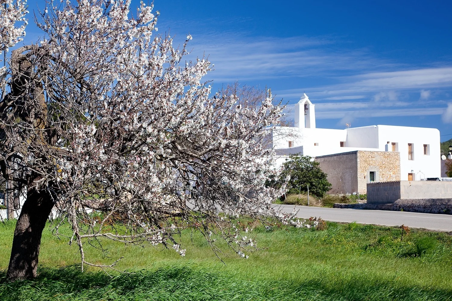
Almond blossom beside the white church at Santa Agnès de Corona
Santa Agnès in blossom / Sant Antoni Tourism
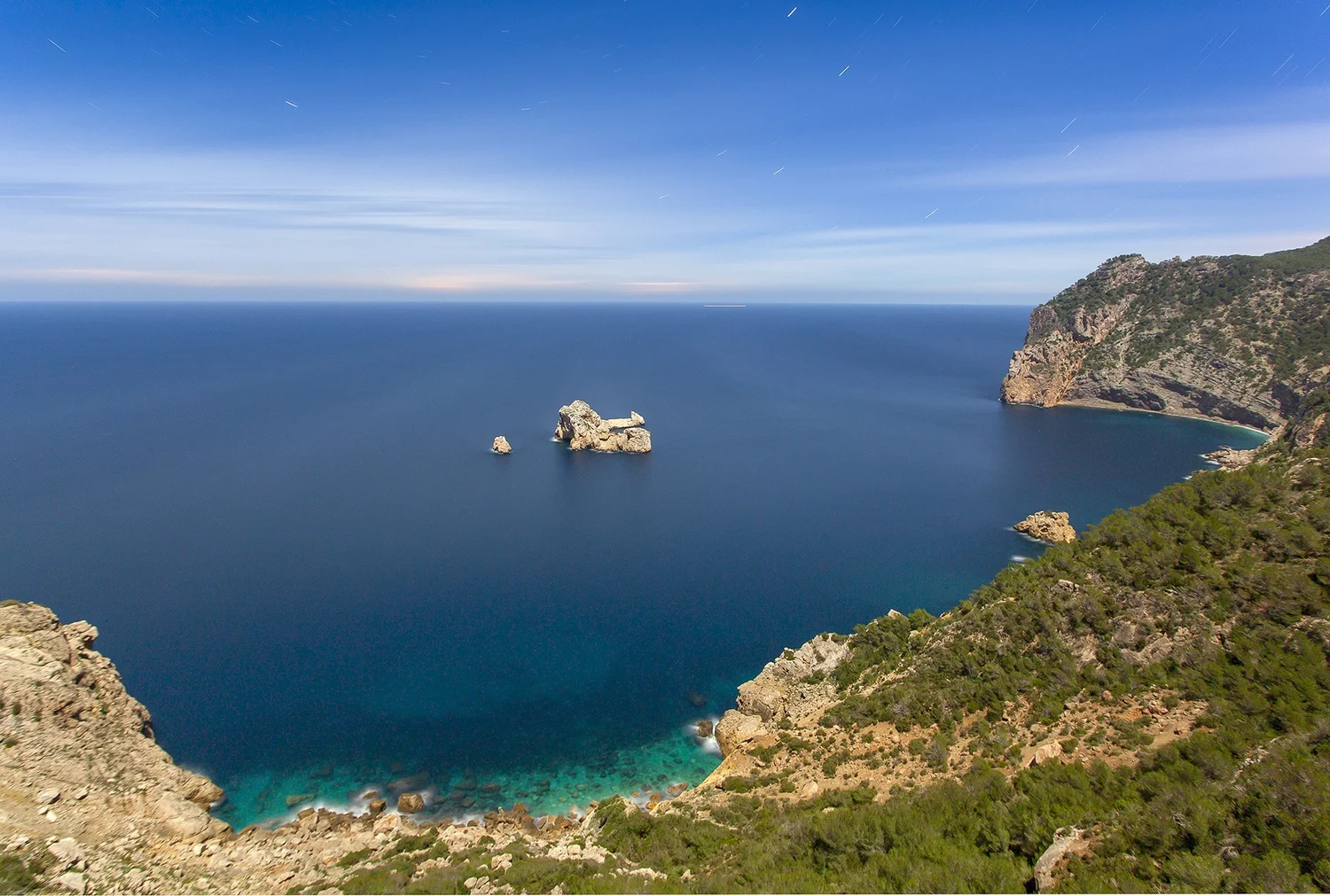
Ses Margalides islets and open sea beyond the cliffs near Corona
Corona / the sea beyond the fields

Santa Agnès de Corona begins with the little church and a cultivated plain. Almond, carob and olive trees establish the scale: individual trunks, boundaries, a patch of earth held by a wall. The official 6.8-kilometre circuit then reaches the western edge around Sa Penya Esbarrada, also known as Puertas del Cielo. Beyond the ground you have just been crossing, the sea opens around the Ses Margalides islets.

It is a very satisfying change of scene. The fields ask you to look nearby; the coast pulls your eye outwards. There is no need to make the entire walk a race towards that second view. Follow the official circuit through the working landscape and notice how the cultivated ground sits within its enclosing hills. An attractive track across a field is not automatically a public continuation of the route.

Almond blossom gives Corona a short season of extraordinary softness, when pale flowers seem to float above the red-brown earth. Later in the year, the same plain is more graphic: trunks, shadows, stone. Both versions have substance. It would be a pity to dismiss the place because you arrived outside the few weeks that appear most often in photographs.

This is a good walk for a conversation that has been difficult to begin across a table. Side by side, nobody has to fill every pause. Back in the square, Can Cosmi’s tortilla supplies a more immediate subject. The village bar began as a grocery and bar in 1951; the food and its terrace facing the church make a persuasive end to a morning in the surrounding fields.

The sea is the surprise. The fields are the reason to linger.

Further into the north

Beyond
the vineyards.

From Sant Mateu’s cultivated plain to the higher country of Es Camp Vell.

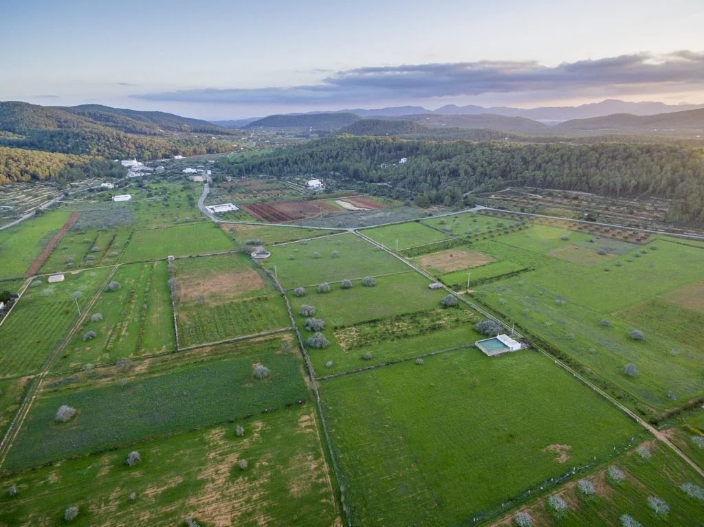
Aerial view across the green agricultural plain around Sant Mateu
Pla d’Albarca / the inland north
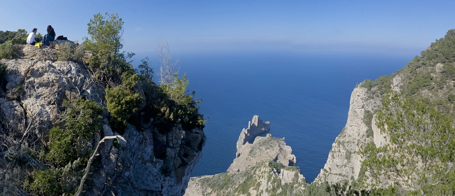
Rocky coastal outlook from the Es Camp Vell walking area
Es Camp Vell / beyond the plain

Sant Mateu d’Albarca makes a quiet beginning for a more demanding walk. The little church and the vineyards around the plain suggest a rural outing, but the municipal Sant Mateu–Es Camp Vell circuit is 10.7 kilometres and graded high difficulty. This is a day for a group that has agreed to go hiking, with the equipment and navigation to match.

Its character comes from the movement between different kinds of land. Pla d’Albarca has the visible order of cultivation; farther along, the route climbs towards Es Camp Vell and a wilder coastal outlook. The plain that felt enclosed from the village belongs to a much bigger landscape. Walking the connection gives the two scenes a relationship that separate stops from the car would miss.

Pack something you will be pleased to eat as well as enough water. A proper pause changes a longer walk: the bag comes off, the pace stops being a negotiation, somebody passes the food. It is a good reason to choose companions with similar expectations about distance and terrain. A qualified local guide is a useful choice for an unfamiliar circuit, particularly if nobody wants to spend the morning interpreting a screen.

On the return, the church and fields of Sant Mateu have acquired another dimension. The Village Edition follows that agricultural setting in more detail. Keep the rest of the day flexible enough to enjoy arriving back; a reservation across the island is an unnecessary clock to carry through the hills.

The northern edge

The striped
northern edge.

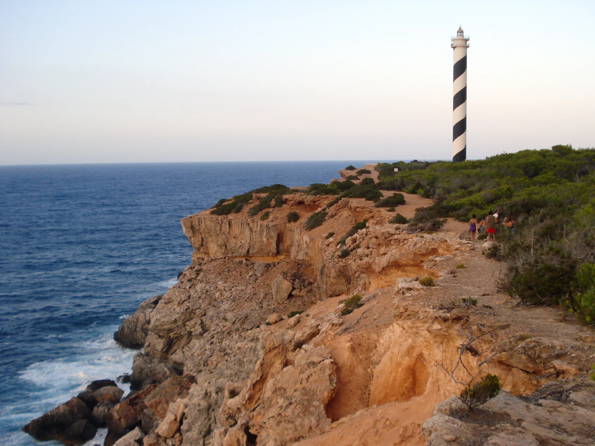
Moscarter gives the rough coast near Portinatx a wonderfully clear point to walk towards.

Walkers on the rocky headland below the black-and-white spiral of Moscarter lighthouse
Moscarter / the northern headland — MsLids, CC BY-SA 3.0 ES

The black spiral around Moscarter’s white tower is visible against a great deal of sky. Beneath it, pale and rust-coloured rock breaks into ledges above the sea, with low vegetation giving way to open ground. After the sheltered water around Portinatx, the headland has a different exposure. The lighthouse explains itself immediately: a deliberate mark at an irregular edge.

There are different outings under the same place name. The longer circuit described by Balearic tourism is about 12 kilometres, continues towards Cala d’en Serra and includes stony or less obvious stretches, stream crossings and road on the return. Walking towards the lighthouse and turning back is a separate plan. Select and save the exact route before leaving; the landmark alone is not a set of directions.

For confident walkers, this northern coast offers a more concentrated experience of rock, wind and water than the inland circuits. Your attention keeps returning to the next stretch of ground, then lifting to the horizon. In calm, suitable conditions that alternation can be absorbing. On an exposed day, choose another walk. The lighthouse will still be there when the weather gives the headland a better morning.

Look a little closer

Salt, wings
and open sky.

At Ses Salines, looking closely can be the whole purpose of the walk.

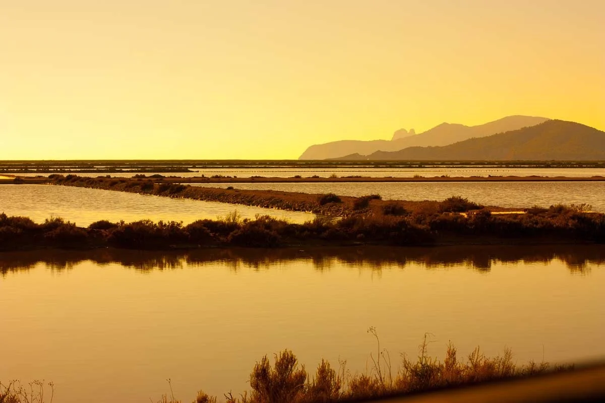
Golden light reflected in the salt ponds of Ses Salines
Ses Salines / water, salt and light
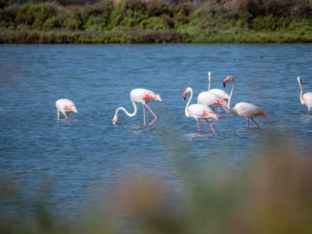
Flamingos feeding in the shallow water of Ses Salines
Ses Salines / look a little closer

The south exchanges height for detail. Salt ponds draw straight lines across the land; the shore makes a much less orderly edge. A tower, a dune, a bird moving through shallow water: each is a reason to stop. Ses Salines is both a working salt landscape and a protected natural park, and that combination gives it more interest than a scenic backdrop alone.

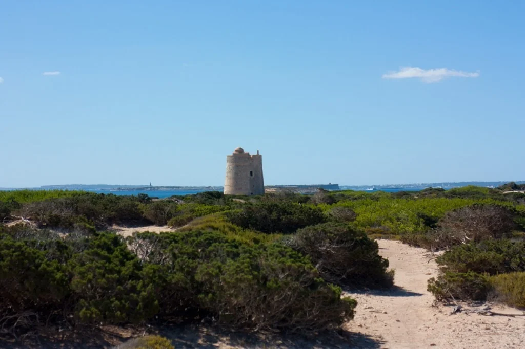
For a coastal outing, the municipal route connects Es Cavallet, Ses Portes and Ses Salines. The tower gives the southern tip a recognisable marker, while the beaches on either side have distinct identities, including Es Cavallet’s naturist character. Plan the return before setting out and stay with the mapped public route. The attraction is the changing ground between the shores as much as either beach.

Ses Portes watchtower beyond a sandy path through coastal scrub
Ses Portes / Sant Josep Tourism

For a quieter morning, take the designated wetland paths and observation points instead. Binoculars make a difference. A bird that barely registers from a distance becomes a shape, a movement and a reason to wait. Flamingos are part of the park’s bird life, but sightings depend on the day; watching what is actually there is more rewarding than searching only for the species in the photograph.

Late light can turn the pond surfaces into broad planes of colour. Enjoy them from authorised routes and hides, leaving dunes, salt works and restricted areas undisturbed. There is something satisfying about a walk whose best moment might be almost motionless: sitting in a hide while the water and the birds continue without you.

Before the first step

A morning
that suits the ground.

Weather, distance and the least confident walker should make the decision together.

Check the weather, wind, daylight and current local restrictions before committing to a route. In hot weather, an early start may help, but it does not make every exposed walk suitable. Carry water for the entire outing, sun protection, a hat, proper footwear and a charged phone. Save the official map offline; do not depend on a bar, mobile signal or shade appearing when you need it.

Agree the route with the whole group and keep enough energy for the return. Leave gates as found, respect cultivated land and keep well back from cliff edges. Changing the plan early is easy to forgive. The walk everyone enjoyed will be remembered more fondly than the distance somebody insisted on finishing.

Back at the table

Back through
the village.

The appetite is part of the reward.

Returning to the same square after a walk is a small transformation. You recognise the turning; the church has become a point of arrival; the table you passed earlier now has an obvious purpose. Sant Josep after Sa Talaia, Corona after its fields, Sant Mateu after the longer circuit: each keeps the morning connected to the land around it.

Later, at the villa, shoes by the door and a shower can be enough of an afternoon programme. If dinner is going to be an occasion, the Dinner Edition can supply the table. A simple supper at home is equally attractive when the day has already given you something to talk about.

Choose your rhythm

Which morning belongs to you?

A few ways to make the idea your own.

Choose the published Sa Talaia ascent. It gives a first walking day a satisfying shape and the best broad sense of the island. Keep the return and lunch around Sant Josep, rather than attaching a second expedition.

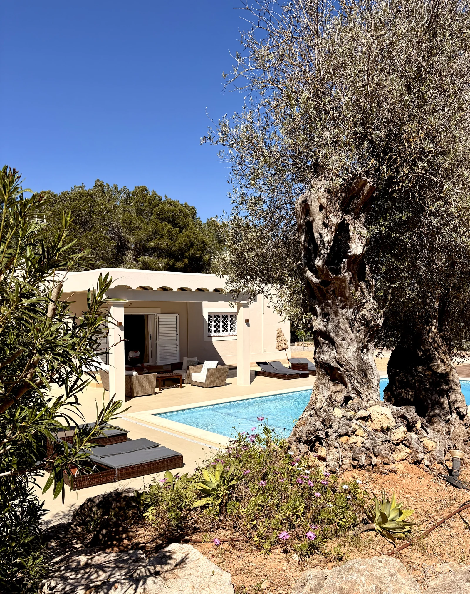
An old olive tree beside the swimming pool and covered terrace at Can Rafa
Can Rafa / The pool. The garden. The quieter hours.

The hours in between

A place
for your people.

The first coffee. The last swim. The table where the stories get told again. Some of the best hours of the holiday happen at home.

At Ocho, you book directly with the people who own and care for our three villas. Tell us your dates, your people and the kind of Ibiza you have in mind. We’ll help you find your place.

A little Ibiza to take with you

Made to keep,
or share!

For the flight, the group chat or the person you wish was here. Keep the magazine. Pass the feeling on.

Download the PDF editionThe Hiking Edition · 20 pages · 3.4 MB

Send a little inspiration

Take the story with you.

The Hiking Edition magazine cover
Save the cover ↓

Make it
your Ibiza.

Three villas. A team who calls the island home.
A holiday that feels like yours.

Find your Ocho villa